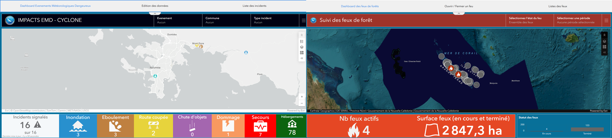
Real-time monitoring suite for cyclones and wildfires, combining a QuickCapture mobile app for field data collection with ArcGIS Dashboard for decision-support supervision.
The DSCGR has expressed a strong need to be able to track hazardous weather events and fires and manage them in real time.
Solution :
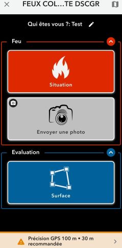
In the field: We deployed a mobile app using QuickCapture. It allows agents to quickly and easily collect incident data (location, reporter, photos, and perimeter).
For supervision: We implemented dashboards. With ArcGIS Dashboards, field data flows back in real time. Firefighters know exactly where the incident is occurring and what type it is, allowing them to prepare their response under the best possible conditions.