A comprehensive GIS solution to conduct field inspections of fire hydrants, manage network compliance, and share real-time water point availability with emergency services.
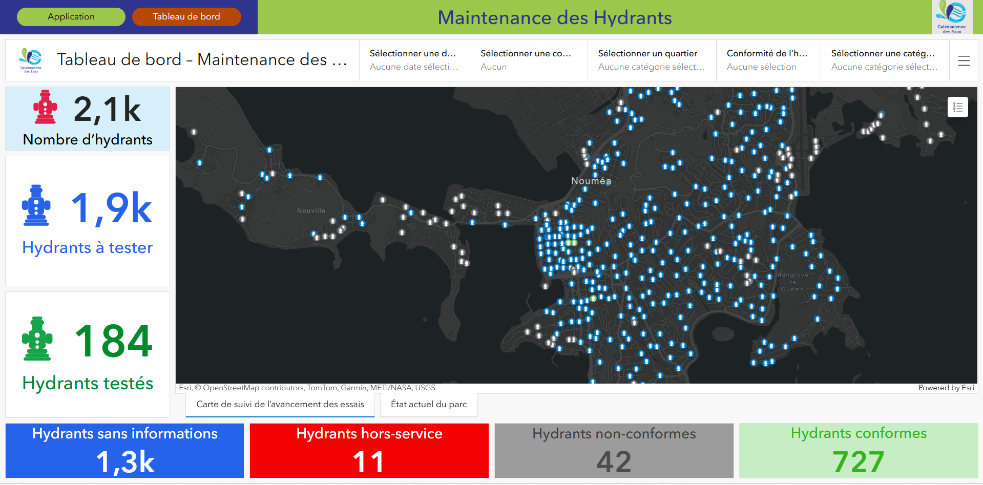
To ensure the safety of its territory, Calédonienne des Eaux needed to modernize and secure the monitoring of its fire hydrant network. Faced with the delays and data loss associated with legacy field surveys, the challenge was to digitize inspections to effectively manage operations, while providing firefighters with immediate access to the real-time status of water points.
Solution:
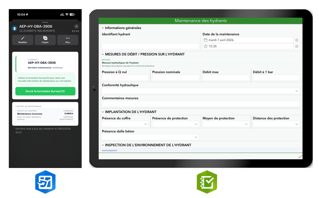
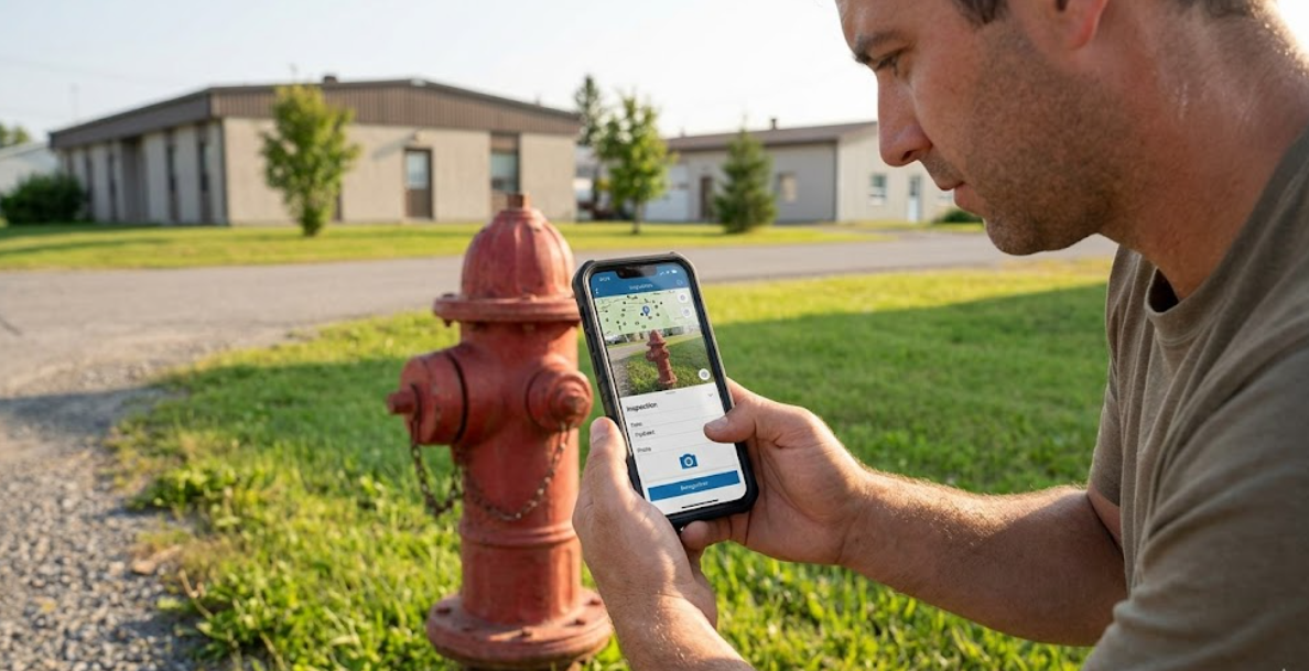
Field side (Data Collection): The Field Maps application allows technicians to easily locate equipment. To facilitate the digital transition, the integrated Survey123 form faithfully replicates their historical paper form. Additionally, it is automatically pre-populated with data from the previous maintenance, ensuring significant time savings during mobile data entry.
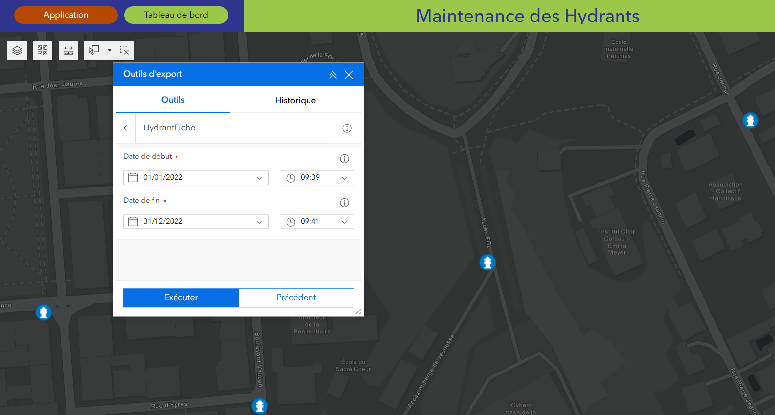
Web side (Control): We implemented an Experience Builder application coupled with a Python script. This custom tool allows for the generation of Excel exports for statistical analysis, as well as dynamic and formatted PDF sheets, facilitating the dispatch of paper reports on demand.